Maxstoke Priory
The remains of Maxstoke Priory, an Augustinian priory of Medieval date. It was dissolved in 1536. The site is 500m northwest of Priory Wood.
1 Sir William de Clinton founded a large chantry or college in 1330. In 1336 he turned it into a priory of Austin canons. The actual charter of foundation was dated 10 March 1337. The priory was to consist of an elected prior and 12 Austin Canons. The grand and stately buildings were not finished until 1342. The priory was suppressed in 1536.
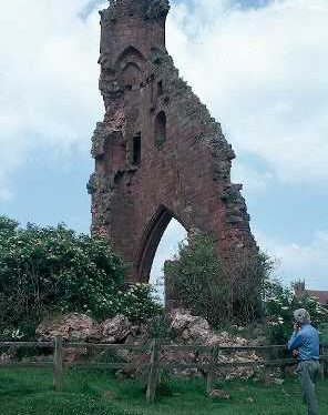
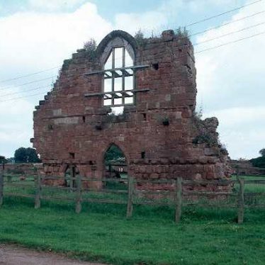
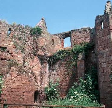
2 The remains lie to the S of the centre of the parish and consist chiefly of the central tower and a few other walls of the priory church, the two gatehouses to the N of it, the W wall of an infirmary hall or chapel to the NE and fragments of a granary &c., to the NW.
3 Priory precincts are enclosed by a wall and the precinct divides into 3 areas. The N area is occupied by farm buildings and the outer gatehouse, the inner court has the remains of the priory buildings. To the W is a large dry fishpond, to the E of this is the watermill and to the N is a rectory with another fishpond.
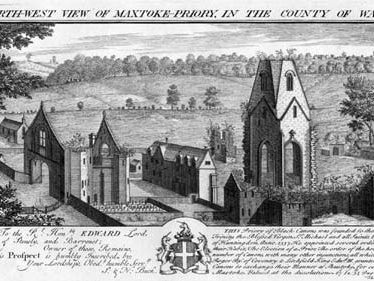
5 Drawing by Buck dated 1729.
6 Scheduled as Warwickshire Monument No 8.
10 The scheduled monument comprises the standing and buried remains of Maxstoke Priory, two fishpond complexes and parts of an associated water management system. The monument also includes the standing remains of the manorial site to the south of the priory. Maxstoke Priory is defined by the surviving sandstone precinct wall which encloses a rectangular area of approximately 250m north-south and 240m east-west. It averages 2.5m high and retains its coping stones for most of its length. It defines three principal courts which are also divided from each other by original sandstone walls. A central or inner court contains the conventual buildings and has the innner gatehouse on its northern side. The agricultural buildings are excluded from the scheduling but the precinct wall is included in the scheduling.
11 Architectural Report by RCHME, 1991
12 Illustrated account giving documentary references and accounts of C19 excavations at one of the last and smaller Augustinian foundations in the County.
13 Architect’s report from 1983.
14 Photograph.
15 Photocopy of large scale map of Maxstoke.
16 Two plans of Maxstoke Priory.
17 Correspondence from 1975-6 about a watching brief on the summit of the moated enclosure.
18 RCHME Archaeological report from 1991.
19 RCHME plan of Maxstoke Priory from 1991.
20 Cover letter for 19.
21 Note from EH following a site visit in 1988.
22 Archival scheduling map.
23 Correspondence relating to the repair of the Priory Gates from 1963 to 1964.
24 Correspondence from 1986-8 about the state of the fabric and unauthorised drainage work.
- For the sources of these notes, see the
- Timetrail record
- produced by the Historic Environment Record.


Comments
Add a comment about this page