


The oldest part of Water Orton is centred around Old Church Road. This is now a conservation area and contains buildings from the 14th and 17th centuries. This is the area that may account for the place name since it is on a high ridge of land overlooking the valley of the River Tame.
The church
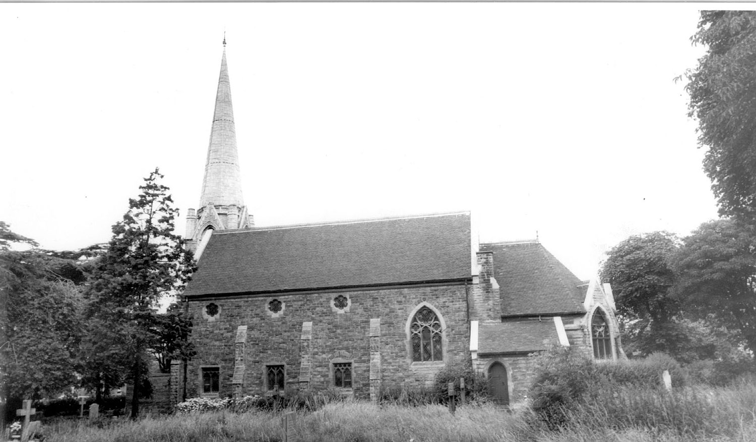
A Chapel of Ease was erected here in the 14th century to save the villagers trudging through the often flooded Tame Valley to the Parish Church at Aston. This was replaced by the present church and all that survives of the Chapel are the listed remains of a medieval cross and the graves in the churchyard. The present Parish Church of St Peter and St Paul was built in 1879 for £4000 to a design by Bateman and Corser. It had a fine spire, which unfortunately had to be dismantled in the 1980s due to the effects of atmospheric pollution.
The coming of the railways
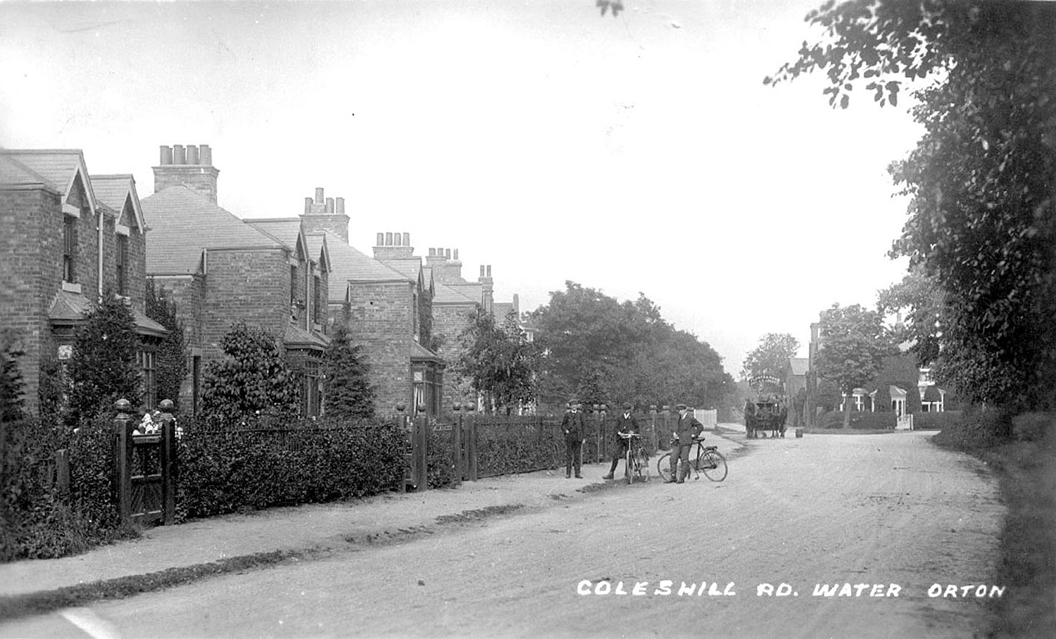
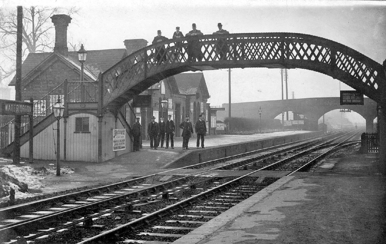
Until the 1840s Water Orton was mainly an agricultural village, but this changed with the coming of the railways. The first one was from Birmingham to Derby via Water Orton, Coleshill, Whitacre Heath and Tamworth. Later a junction was constructed and another line was built via Kingsbury to Tamworth. The lines pass through the centre of the village.
The present railway station dates from 1908 and is the second station. There were extensive sidings and much commercial traffic here, especially during and after the Second World War, until the activities of Dr Beeching in the 1960s. An effect of the railway was to increase house building in the village. Commuters could now make the journey to Birmingham’s Lawley Street and Curzon Street (later New Street) railway stations in a shorter time than by road. This made the village an ideal residential area for Birmingham professionals who wanted to get away from the city and live in the country.
The meat industry
The railway also brought the meat industry here. There were large stock yards near the sidings and next to the Dog Inn in Marsh Lane. Cattle were offloaded from rail wagons into pens, then driven two miles down the road to butchers’ slaughter houses in Castle Bromwich, when meat was provided for nearby villages.


Comments
Add a comment about this page