Shrunken Post Medieval Settlement at Sawbridge
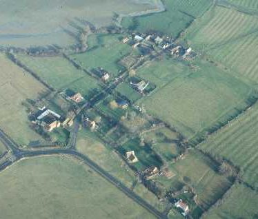
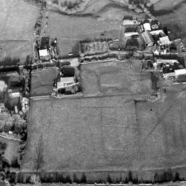
The possible site of a Post Medieval shrunken village for which documentary evidence survives. House platforms, a hollow way and ridge and furrow cultivation are all visible as earthworks. The site is located 500m to the east of Sawbridge.
1 There were 29 houses at Sawbridge in 1730.
2 Today there are fewer than ten houses and this indicates depopulation after 1730. There are probable house platforms on either side of the road between ‘The Farm’ and ‘Leam Farm’ (see also PRN 3045).
3 Earthworks also survive in the field east and north of Sawbridge, comprising a hollow way, toft plots and flanking ridge and furrow.
4 Plan drawn up during site visit of 3
5 The earthworks were subject to topograhpic survey and the development was subject to a watching brief during development adjacent to Beau Geste. 2 large rectalinear platforms were recorded, together with two other possible platforms and a series of trackways running between them. During the watching brief, a possible medieval cobbled surface was recorded, together with a single sandstone block, possibly from a wall feature.
- For the sources of these notes, see the
- Timetrail record
- produced by the Historic Environment Record.


Comments
Add a comment about this page