
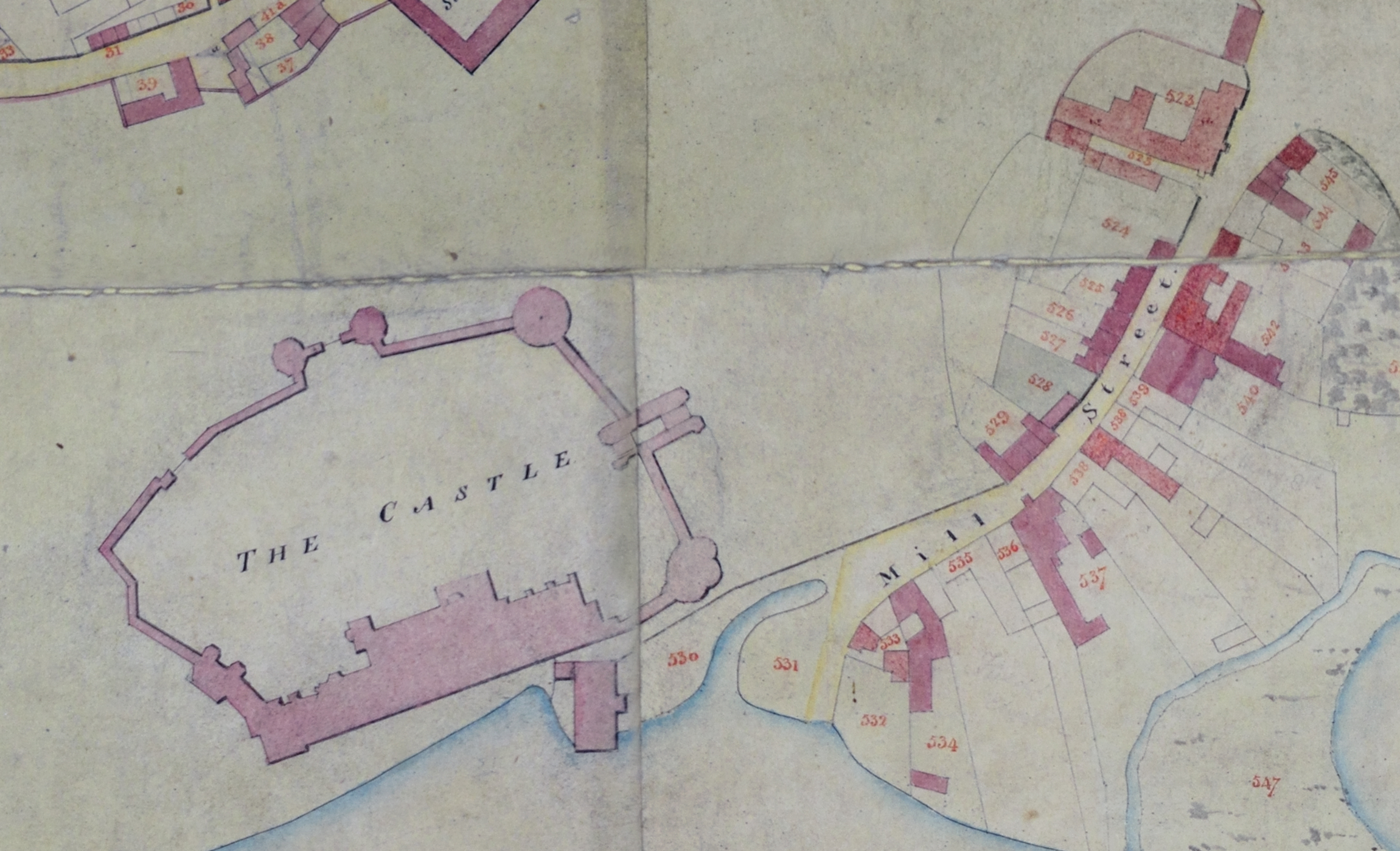
This highly detailed map (by William James and Assistants) illustrates the properties owned by the Earls of Warwick in Warwick at the opening of the nineteenth century. It is presumed that the properties highlighted in red are those owned by the Earl’s estate. The numbering system may have originally corresponded to a list compiled in a book for the estate records.
This specific map was produced during the ownership of George Greville (1746-1816), 2nd Earl of Warwick. An enthusiastic and energetic patron of gardens and the arts, George spent the early part of his ownership making many improvements and additions to Warwick Castle. This included purchasing original works by Rembrandt, Rubens and Van Dyck, alongside improving the castle’s vast parkland. Unfortunately for George, the later part of his life was consumed by crippling debt due to his extravagant purchases and his generous good nature. It is estimated that the Earl’s debts stood at £70,321 after his death in 1816.
An attempt to reassert control
This map, commissioned by estate manager William James, may have been produced in an attempt to reassert control over the Earl’s finances. A detailed map such as this, which also allows for strategic purchasing as well as sales, would have proved instrumental in allowing his estate managers to administer to his property in the most efficient way possible.
Much of the property owned by the Earl of Warwick was sold in the mid twentieth century by Charles Fulke Greville, 7th Earl of Warwick, including the many buildings they owned in Mill Street. The Castle and grounds were eventually sold to an entertainments company by David, Lord Brooke, in 1978.


Comments
Add a comment about this page