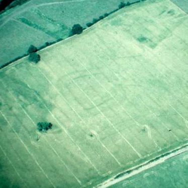
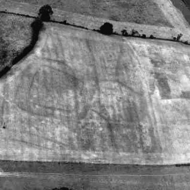
Undated crop mark settlement, Barford
Cropmarks revealing the site of a settlement at Barford
Warwickshire County Council
A double-ditched enclosure, possibly a settlement, visible as a cropmark west of Barford
WA Baker
Description of this historic site
A rectangular double ditched enclosure, associated linear features and a possible trackway of unknown date are visible as cropmarks on aerial photographs. It has been suggested these features represent a settlement. They are located 800m west of the cemetery, Barford.
Can you help?
Notes about this historic site
2 Rectangular double ditched enclosure associated with linear features and a possible trackway to the S.
3 Cropmarks very clear on Google Earth satellite imagery from 2006.
- For the sources of these notes, see the
- Timetrail record
- produced by the Historic Environment Record.


Comments
Add a comment about this page