Blackwell Medieval Settlement
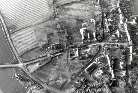
The possible extent of medieval settlement in Blackwell as indicated on the Ordnance Survey map of 1886 and on aerial photographs.
1 The probable extent of the Medieval settlement as deduced from the first edition 6″ map, 35SW 1886.
2 The ridge and furrow is seen to survive all round the village, and very close to the settlement, except to the south where there is slightly less.
3 The Domesday entry is listed under Worcestershire, (grid ref 2443). Ref EW2:-
[Land of Worcester Church] At Blackwell are 2 hides which belong to the supplies of the monks. In lordship 3
ploughs; 10 villagers and 6 smallholders with 4 ploughs. 6 male slaves and 1 female slave; meadow, 10 acres.
The value was and is 50s.
4 The 1886 map shows a village intact. The ridge and furrow runs right up to the boundary on all sides except for the SE corner. Some of the orchard/garden areas look as if they were deserted plots; the larger ones look as if they were always gardens.
5 Blackwell remained with the Prior and convent until the dissolution of the monasteries. Two years later (1542) it was granted to the Dean and Chapter of Worcester Cathedral, who held it until 1654 when it was sold by the Parliamentary Commission of Nicholas Lockyer of London. At the Resoration of Charloes II it was given back to Worcester Cathedral and was confirmed to them in 1692. Afterwards it was assigned to Shipston manor.
- For the sources of these notes, see the
- Timetrail record
- produced by the Historic Environment Record.


Comments
Add a comment about this page