Whatcote Medieval Settlement
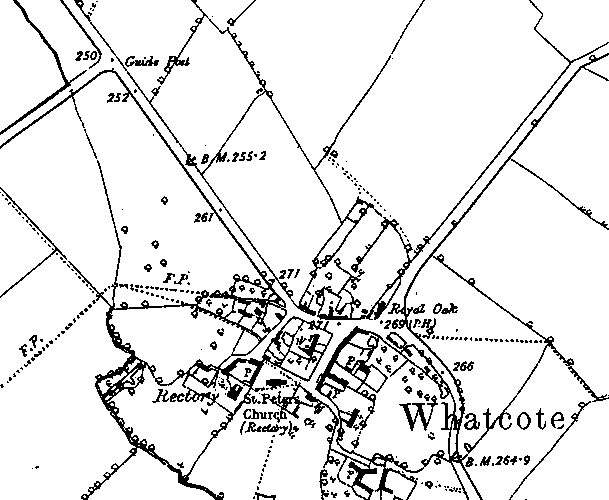
Probable extent of Medieval settlement in Whatcote as indicated on the Ordnance Survey map of 1886.
1 The possible extent of the medieval settlement, based on the first edition OS 6″ maps of 1886, 24 SE, and 54 NW.
2 Domesday lists Whatcote in Fexhole Hundred. The Phillimore edition has a grid reference of 29,44.
Ref 18,12 Roger holds 5 hides in Whatcote. Land for 5 ploughs. In lordship 4. 7 villagers with a priest and 19 smallholders have 3 ploughs. The value was 100s; now £7. Toli held it freely.
3 The first edition maps show a small village mostly grouped around a central square area which contains plots. The stream to the south forms a boundary, as does the road to the east. The parish has not been plotted for ridge and furrow, but the mapdata shows survival abutting the stream to the southwest, and a small area close to the village to the northwest. The church [WA 2276] dates to the C12th, and there are the remains of a cross in the churchyard [WA 2277].
- For the sources of these notes, see the
- Timetrail record
- produced by the Historic Environment Record.


Comments
Add a comment about this page