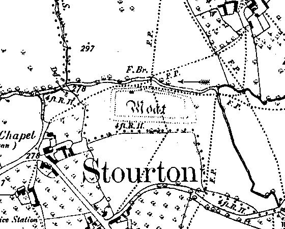
Moated Site 300m SW of Sutton under Brailes
Description of this historic site
The site of a Medieval moat, a wide ditch usually surrounding a building. The remains are visible as an earthwork, and situated 200m northeast of Stourton Wesleyan Chapel
Can you help?
Notes about this historic site
1 On the S bank of the River Stour extensive remains of a moat mark the site of a manor house.
2 This moat contains in its E half a disturbed area, probably the foundations of the house and, to the W, the remains of an internal fishpond. The ‘stone’ published on the OS 6″ within the moat no longer exists.
4 The moat is of elongated rectangular shape. To the N of the island are traces of a small stone hut.
6 Copper/iron object, possibly a rivet from a piece of armour, found by metal detector at Lane’s End Farm, Stourton.
7 Scheduled in 1999.
- For the sources of these notes, see the
- Timetrail record
- produced by the Historic Environment Record.


Comments
Add a comment about this page