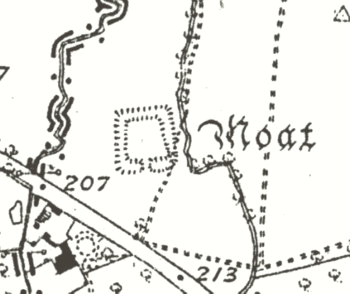
Moat at Broughton Deserted Settlement, Whitchurch.
A moat, a wide ditch usually surrounding a building, associated with Broughton Deserted Medieval Settlement. It survivies as an earthwork, and is situated to the north east of Admington.
1 A dry Medieval moat.
2 There is no surface evidence of a building on the island.
4 The moat is about 30m square with an entrance on the S. The depth varies from 1m to 2m. There is no surface evidence for a building on the platform.
7 The island slopes W-E and the E ditch may have been partly infilled. The moat was probably fed from a stream at its SE corner. The N outer side of the moat is formed by an external bank, or dam, and there is a lower area to the N. The farmer recalls a stone wall about 1.2m thick being uncovered revetting the inner side of the moat during his childhood.
8 The moat lies to the north of Bruton deserted Medieval settlement. It is thought to be the original site of the Medieval manor house associated with the settlement. The interior of the moat is raised 1m to 2m above surrounding ground levels and is undulating with earthworks representing possible building remains in the north western portion of the island. Other small irregular platforms also survive to the south of the moat, these are thought to represent the remains of other agricultural and ancillary buildings associated with the manor.
9 Monument scheduled in 1999.
- For the sources of these notes, see the
- Timetrail record
- produced by the Historic Environment Record.


Comments
Add a comment about this page