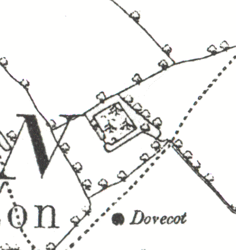
Moat 100m N of Dovecote, Kinwarton.
Description of this historic site
A Medieval moat, a wide ditch usually surrounding a building. It is visible as an earthwork and is situated 100m north of Kinwarton Church.
Can you help?
Notes about this historic site
1 The site of the manor house (PRN 1567), a small inclosure surrounded by a moat.
2 The remains of a homestead moat are extant at the published site. Adjacent to the moat are the slight remains of a fishpond.
4 1981-2: Survey undertaken. The shape of the moat is comparable with other sites in the area, although the enclosure is rather smaller.
6 Moat about 38m square. About 6-9m wide and 30cm to 1.5m deep. The N and W arms are waterfilled.
7 Aerial photographs.
8 Noted.
- For the sources of these notes, see the
- Timetrail record
- produced by the Historic Environment Record.


Comments
Add a comment about this page