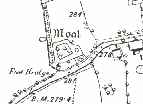
Moat 200m S of Church
Description of this historic site
A Medieval moat, a wide ditch usually surrounding a building, is still visible as an earthwork. It is marked on the Ordnance Survey map of 1886. The moat is situated 150m southwest of St Nicholas's Church, Willoughby.
Can you help?
Notes about this historic site
1 Moat marked.
2 A substantial homestead moat with a lead-in drainage ditch to the N. The island is densely tree-covered; no building foundations were noted.
3 The moat is very overgrown and still contains water.
4 Moat roughly 55m x 67m with a possible external enclosure bank on the E. The moat is about 5-14m wide and 1-2m deep and is wet.
- For the sources of these notes, see the
- Timetrail record
- produced by the Historic Environment Record.


Comments
Add a comment about this page