Deserted Settlement 200m S of Stoneton Manor
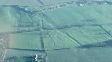
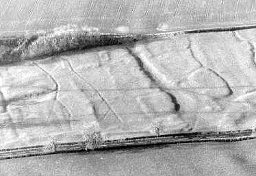
The site of a Medieval deserted settlement. The remains of the settlement are visible as earthworks and as ploughed out remains on aerial photographs. The settlement site is located at Stoneton, 300m north of Berryhill Plantation.
1 Transferred from Northants, 1896. It is an abandoned site. It appears SW of Stoneton House, between the house and the pool.
2 Very good archaeology (A). Period of archaeology known, but documentary evidence inferior in quantity.
3 Extensively covered with surface mounds and gullies. Some of the gullies are meandering and appear to be stream beds. Roughly in the centre of the field is a deep cut hollow way, running E-W and entering a marshy pool at the edge of the stream. This has the appearance of the main street of the village. Apparent house platforms can be discerned here as also in the NE corner and the S end of the field. The adjacent field No 16 was ploughed and is exceptionally stony. This may be simply stony ground, but some of the stones appear to be dressed and could be from the village site.
4 Banks, ditches and the water system are visible – permanent pasture.
7 Air photographs show enclosures, hollow ways and linear boundaries in the field surveyed by the OS and the field immediately to the E.
8 Stoneton appears in the Domesday Book with fourteen households. It them seems to disappear; it does not figure on the Lay Subsideies of 1327, 1332 or 1524. Shifting jurisdictions may account for its non-appearance in these subsidies, e.g. in 1896, Stoneton was transferred to Warks for Northants.
- For the sources of these notes, see the
- Timetrail record
- produced by the Historic Environment Record.


Comments
Add a comment about this page