Deserted Medieval Settlement at Watergall
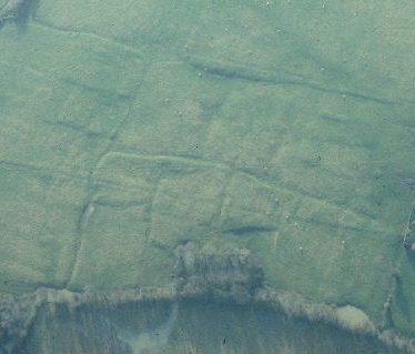
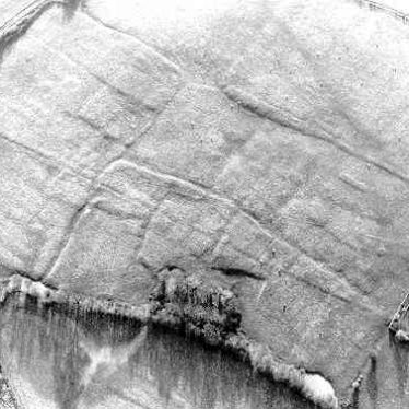
The site of the deserted settlment of Watergall which dates to the Medieval period. House platforms, crofts and hollow ways are visible as substantial earthworks. The site is located west of Watergall Bridge.
1 This is in the Hodnell group of villages. Hodnell parish consisted in its heyday of Hodnell, Chapel Ascote, Watergall and Wills Pastures. The site is visible on aerial photographs SE of Manor Farm on the stream. It may not have been more than a hamlet of Hodnell.
2 ‘Hodnell II’. Very good pattern of roads and crofts, but no house sites visible (A); small quantity of documentary evidence (3).
5 The main centre of population in Hodnell parish would seem to have been at Watergall. This place name is not recorded before the late 15th century and it would be more accurate to call this site Hodnell II.
7 The earthworks indicate a well-defined village. A good pattern of roads and crofts is easily discernible, as are house platforms. A main hollow way leads from the manor house to the Watergall – Burton Dassett footpath, from which other minor roads lead off between the crofts. The further well-defined hollow ways run parallel to the former. The E side is bounded by the stream.
8 Various air photographs.
9Size of village increased to reflect earthworks visible on lidar image
- For the sources of these notes, see the
- Timetrail record
- produced by the Historic Environment Record.


Comments
Add a comment about this page