Charlecote Park (18th and 19th Century Park)
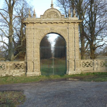
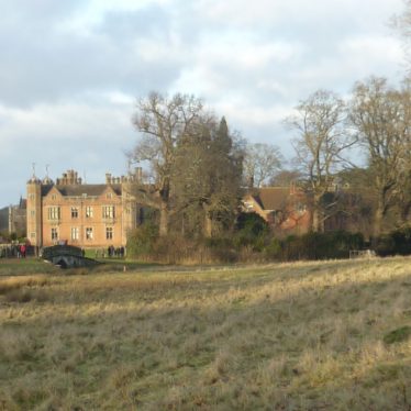
A landscape park dating to around 1757 and designed by Capability Brown, though some redesigning was undertaken in the 19th century. The features include a ha-ha, clumps, a lake and a lodge. Kitchen garden. Charlecote Park is marked on the Ordnance Survey maps from 1886.Recommended to review Register entry by Lovie.
1 Charlecote House was begun in 1558 for Thomas Lucy; at this period the house was surrounded by formal gardens and a deer park. The park was remodelled by Capability Brown c1757, obliterating most of the formal elements and creating a wilderness, bounded by a ha-ha, to the north of the forecourt. Parterres and terraces were created in the 19th century, but much of the garden was reduced to lawn by the 1950s. The National Trust took over the property in 1946 and since 1956 substantial garden restoration has been taking place.
2 The parkland created by Capability Brown overlay an earlier formal scheme. There were further alterations and developments in the 19th century, and the surviving pleasure grounds have a 19th century character. Features include parkland with lodge, drive, avenues, lake, clumps, ha-ha, pleasure grounds with parterre terrace, shrubberies, conservatory, kitchen garden, orangery.
3 Charlecote was the first park in the area to be redesigned by Capability Brown in the mid 18th century.
4 Soon after George Lucy inherited the estate in 1744 work began on relandscaping. Capability Brown was involved by 1757, at which date his unfinished survey plan of Charlecote was made, and was formally commissioned in 1760. By this time the road had been diverted away from the house, across a new bridge, and considerable planting had already been undertaken. Payments to Brown were made between 1761 and 1778, during which period a number of features including the cascade were completed. In the first half of the 19th century the house was restored and the gardens remodelled (illustrations of the 18th century gardens survive); many features of the 19th century gardens survive.
5 The OS 1:10560 1886 Sht Warks 44NE shows the western half of the park shaded, and a number of tree plantations.
6 The OS 1:10560 1886 Sht Warks 45NW shows an avenue extending beyond the line of the Wellesbourne road.
7 The OS 1:10560 1938 Sht Warks 44NE shows an avenue extending west beyond the line of the park marked in 1886.
8 The OS 1:10560 1906 Sht Warks 45NW shows the eastern half of the park shaded; the avenue shown on the 1886 map is no longer visible.
9 Discussion of development of the park.
10 Illustrative map for 9.
11 Park shown on Greenwood’s map of 1822.
12 Management plan produced for the National Trust. Source contains discussion of development of deer park using a range of documentary and cartographic sources. Also contains an archaeological survey report.
- For the sources of these notes, see the
- Timetrail record
- produced by the Historic Environment Record.


Comments
According to a a Mrs Bennett of Charlecote, speaking in about 1910, said that a few years before witches used to meet secretly in Charlecote Park. One of them was called Diana and she used to ride a buck. Apparently this particular coven had the ability to turn people into cattle!
Sources: “Haunted Warwickshire” by Meg Elizabeth Atkins
“Folklore of Warwickshire” by Roy Palmer
Add a comment about this page