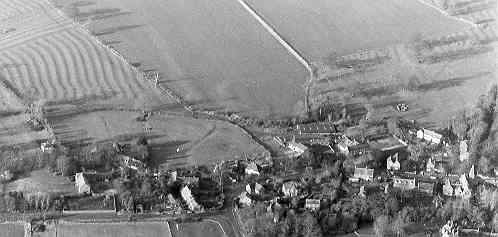
Avon Dassett Medieval Settlement
The probable extent of settlement at Avon Dassett during the Medieval period which has been identified on the Ordnance Survey map of 1886.
1 The probable extent of the Medieval settlement based on the first edition 6″ Ordnance Survey map, 52NE 1886.
2 Listed in Domesday in Hunsbury Hundred. Grid ref: 4150. Ref 16,5:-
(land of the Count of Meulan) in (Avon) Dassett 10 hides. 3 thanes held it; they were free.Land for 12 ploughs. In lordship 3 ploughs; 10 slaves. 12 villagers with a priest and 5 smallholders have 7 ploughs. Meadow 50 acres. Value now £8.
3 The ridge and furrow plotting for the parish shows extensive survival, particularly to the south and west. There is a featureless area between the edge of the ridge and furrow and the settlement, both to the northwest and the southeast.
- For the sources of these notes, see the
- Timetrail record
- produced by the Historic Environment Record.


Comments
Add a comment about this page