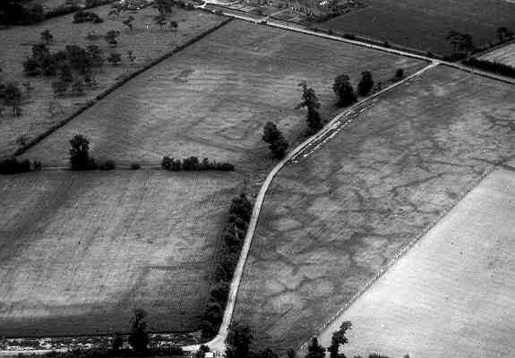
Site of Undated Settlement 600m NW of Church
The possible site of a settlement. Enclosures, pits, ditches, and a possible field system are visible as cropmarks on aerial photographs. Its date is uncertain, but it could be Iron Age. The features are situated 500m north west of the church at Salford Priors.
1 Aerial Photograph
2 A double ditched rectangular enclosure about 60m x 30m with a narrow entrance through both ditches on the SE. Inside the enclosure are two adjoining enclosures – one penannular gully with an entrance to the SE and one irregular. Also inside the enclosure is a scatter of pits. Also traces of a possible field system exist to the S (MWA6291). On morphological grounds this site is probably of Iron Age date.
3 Note, as above.
4 5Enclosures and ditches mapped as part of the English Heritage National Mapping Project.
- For the sources of these notes, see the
- Timetrail record
- produced by the Historic Environment Record.


Comments
Add a comment about this page