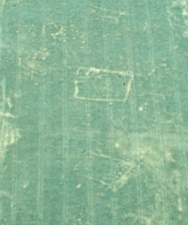
Undated linear cropmark near Broom.
Aerial photographs showed enclosures, pits and linear features at this site. Geophysical and field surveys produced evidence of further pits and of multi-period occupation. The site lies 500m north west of the weir at Broom.
1 Undated small enclosures, linear features and pits show on air photographs.
3 During a field evaluation carried out by Warwickshire Museum in advance of construction of the Norton Lenchwick Bypass 499 sherds of later Bronze Age pottery were found in Trench 5, Pit 501. This find is of considerable local significance, comparable with Wasperton & possibly suggesting some abnormal function for the pit. (Trench 5) revealed a large hollow containing a possible sunken hut structure and Saxon period pottery. This is of considerable local significance. Fieldwalking in advance of construction of the A435 Norton Lenchwick Bypass produced 15 worked flints from Field 32 and 22 from Field 35.
4Three different phases were excavated in area E: 1) unusual funerary deposits dating to the later Neolithic (see WMA 7454), funerary/ritual activity during the later Bronze Age (see MWA 7229), and domestic activity in the Saxon period (see MWA 7230).
6 Geophysical survey revealed several pit like responses that suggest archaeological activity may continue eastwards from the recorded cropmark complex into the corridor of the proposed bypass.
7 Dating narrowed to within the Neolithic and Romano British periods.
8 The enclosures, linear features and pits evident on aerial photographs were mapped as part of the English Heritage National Mapping Project.
- For the sources of these notes, see the
- Timetrail record
- produced by the Historic Environment Record.


Comments
Add a comment about this page