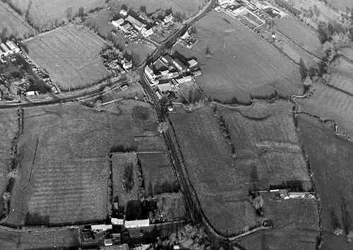
Shrunken Med Settlement 150m SW of Chapel Green Farm
The possible site of a Medieval shrunken village. A hollow way is visible as an earthwork. The site lies to the west of Chapel Green.
1 In Bays Green is a very deep hollow way typical of those associated with DMVs in the heavy clay soils of the Feldon. Aerial photography shows the hollow way clearly ending in a Y at the E end. The S end of the Y links with the road at Fens Cottages, and the N end points to Chapel Green Farm.
2 The 1973 excavation is shown as ‘E’. Mapping for the monument extended to include this area.
3 Field is roughly triangular and bisected by a hollow way. The hollow way is over 2m deep at its deepest point. To the S is a back lane widening to an open space adjacent to a large platform. W of the hollow way lies a stream and open fields, to the E a flat area, possibly the Green, adjoins the road to Marston Doles. At the N bifurcation of the hollow way is a building which was excavated in 1973 (PRN 6215).
- For the sources of these notes, see the
- Timetrail record
- produced by the Historic Environment Record.


Comments
Add a comment about this page