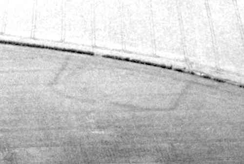
Possible Site of Heathcote Deserted Medieval Settlement
Documentary evidence suggests that the possible site of the Medieval deserted settlement of Heathcote is located 500m north of New House Farm.
1 Heathcote in Warwick. Dugdale places it near Myton, where there are today a Heathcote Hill and Farm. The Heathcote in Rous is probably the Heathcote in Wasperton (PRN 2208).
2 Shown by Beighton as depopulated. No further information obtained during field investigation around SP3063 (see PRN 4614).
4 Irregular enclosure shows on aerial photographs.
5 The same enclosure is marked and called ‘The Township’ on a map of 1696.
6 1984. Field survey produced seven Medieval sherds from this area which is under plough. There are no surface traces of the earthworks.
7 Uncertain whether this is the site of Heathcote Village.
8 Some doubt must remain over the identification of the site because of the small quantities of Medieval pottery. Field survey by Richard Fowler in 1984 produced 7 Medieval sherds from the area of the cropmarks.
9 Plan of the cropmark.
10 The cropmark visible in 3 appears to be part of a larger complex which straddles the field boundary. Very subtle positive cropmarks are visible on Google Earth imagery c. 2006, which appear to indicate ditched enclosures. Ploughed out ridge and furrow is also evident on the northern and western boundaries of these enclosures, indicating the in-fields associated with this settlement.
- For the sources of these notes, see the
- Timetrail record
- produced by the Historic Environment Record.


Comments
Add a comment about this page