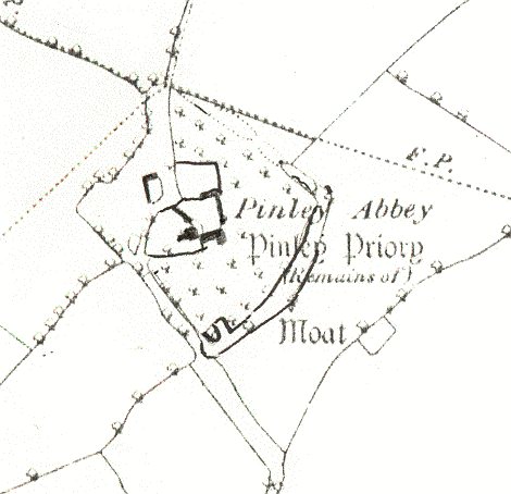
Moat at Pinley Priory
Description of this historic site
The remains of a Medieval moat, a wide ditch which usually surrounded a building. The moat is partially visible as an earthwork and is situated at Pinley Priory, 700m south east of Great Pinley.
Can you help?
Notes about this historic site
1 There are considerable remains of a moat enclosing a large area to the S, SE and E of the Priory buildings. It dies out to the N of the E part and stops short at a farm road and ditch at the W end of the S part.
2 The moat does not appear to have encircled the site of the Priory. The ground slopes appreciably from NW to SE and only the E part could have held water.
3 Enclosure roughly 162m by 155m with external enclosure banks. Moat varies from 3m to 15m wide and is up to 2m deep.
- For the sources of these notes, see the
- Timetrail record
- produced by the Historic Environment Record.


Comments
Add a comment about this page