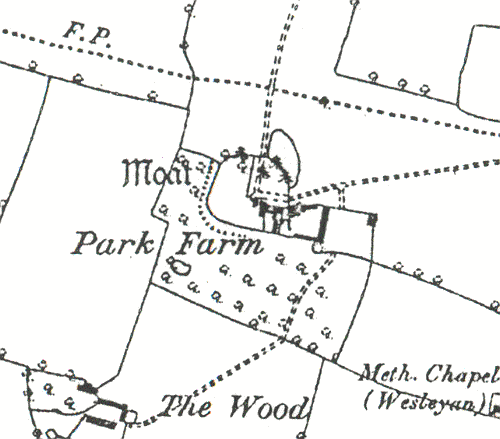
Moat at Park Farm, Barnacle
Description of this historic site
The site of a Medieval moat, a wide ditch usually surrounding a building. Two sides of the moat are visible as an earthwork. The site is located 300m west of Barnacle.
Can you help?
Notes about this historic site
1 A homestead moat. The remains consist of a dry ditch on the S and W sides only. The farmhouse in the enclosed area is fairly modern.
2 An L-shaped ditch, probably the remains of a moat, between 0.5m and 2m deep, and up to (?)2m wide. It is dry and overgrown with nettles, bushes etc.
3 Moated site survey.
- For the sources of these notes, see the
- Timetrail record
- produced by the Historic Environment Record.


Comments
Add a comment about this page