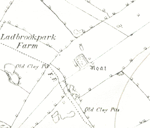
Moat at Ladbroke Park
The site of a probable moat at Ladbroke Park. A wide ditch usually surrounding a building, it dates to the Medieval period. It is still visible as an earthwork. The moat is situated 600m southeast of Ladbrookpark Coppice.
1 1968: A complete homestead moat. There is no surface indication of a building within. 1976: A small, square, waterfilled moat, measuring overall 40m each way, the arms being 8m in width, and the site being on a slight slope, from 1.8m on the NW to 0.5m on the SE in depth. The island has been raised and levelled, so that on the SE it stands 1.5m above the outside ground level and on the NW a little above it. Outer retaining banks on the SW and NE are some 6m in width and 1.5 and 0.5m in height respectively. The wooded island is reached by a causeway across the S end of the NE arm. A stream flowing through the SE arm from the NE fed the site.
2 The moat was probably little more than a shooting box.
3 The N and NE arms are now dry. The island is level and largely overgrown.
5 It is contested that the moated site was the hiding place for a group of priests during the 16th century.
- For the sources of these notes, see the
- Timetrail record
- produced by the Historic Environment Record.


Comments
Add a comment about this page