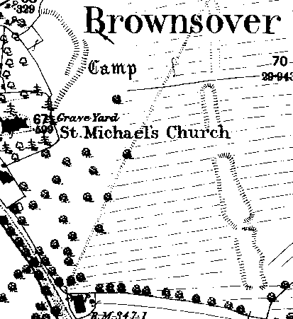
Fishponds 200m SE of Brownsover Church
The site of a Medieval or Post Medieval bank and three fishponds, used for the breeding and storage of fish. They are marked on the Ordnance Survey map of 1926. They are situated 100m west of Blaeberry Street, Brownsover.
1 Three fishponds marked.
2 Photograph.
3 An archaeological evaluation including documentary research and ground investigation was undertaken prior to housing development. The fishponds probably belonged to the manor of Brownsover. They may have been Medieval or Post Medieval in origin. The earliest definite reference to them dates to 1705/6. The ponds were buried in up to 2.5m of modern debris by the 1960s. The fishponds consisted of a series of three subrectangulaar ponds created by damming an earlier, existing stream. The relationship of the ponds to the ridge and furrow on either side may suggest a Post Medieval (or late Medieval) date.
- For the sources of these notes, see the
- Timetrail record
- produced by the Historic Environment Record.


Comments
Add a comment about this page