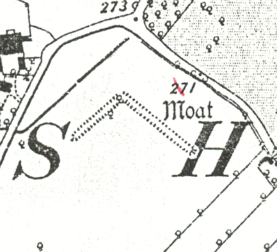
Site of Moat at Wishaw Hall Farm
The site of a moat, a wide ditch usually surrounding a building, and a fishpond used for the breeding and storage of fish, which were Medieval in date. They were situated to the west of Moxhull Park, Wishaw.
1 Part of an extensive series of earthworks including fishponds to the E and SE of Wishaw Hall Farm.
2 Plan.
3 A moat. What remained of the moat was filled in in 1973.
4 It is not certain that the earthwork was a moat as opposed to an additional fishpond.
5 In c1973 all that remained was an L-shaped hollow in the field, representing the two arms of the moat. This was filled in by the farmer.
6 Evaluation confirmed the existence of an unfinished moat which was never functional. Extensive trenching of the area enclosed by, and surrounding the moat recovered no evidence for occupation. The site has been extensively damaged by levelling.
7 The final interpretation of this L-shaped feature is that it is an off-stream pond. No evidence was found for a manor house enclosed by this ‘moat’ feature.
- For the sources of these notes, see the
- Timetrail record
- produced by the Historic Environment Record.


Comments
Add a comment about this page