Water Orton Medieval Settlement
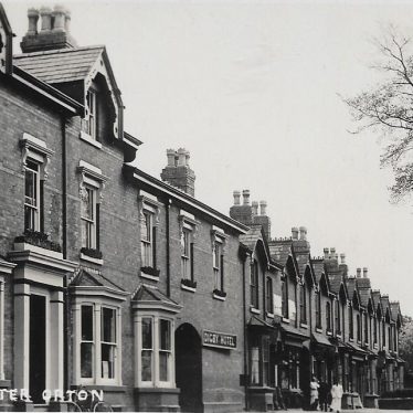
Digby Hotel, 1 Coleshill Road, Water Orton.
Image supplied by Michael Lee
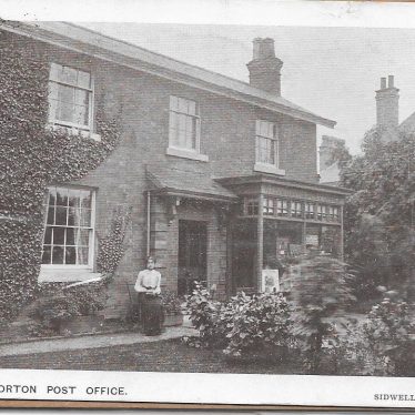
Later referenced as Rose Cottage and 18 Coleshill Road, Water Orton.
Photographer Sidwell, Meriden. Image supplied by Michael Lee
Description of this historic site
The probable extent of the medieval settlement based on the Ordnance Survey map of 1887.
Can you help?
Notes about this historic site
1 The probable extent of the medieval settlement based on the OS map of 1887, 9SW.
2 The village was not listed in Domesday.
3 The 1887 shows an extensive village with more than one centre. The northern part includes the site of the medieval church [WA34), so this was perhaps the earliest area of occupation. South of the railway the settlement may all be post medieval as the lines of the plots are rather straight, but The Green is marked, and on the southeastern side, east of the Vicarage there are several little strip type fields with curved lines. There is no ridge and furrow transcription of the parish at present to help clarify the boundaries.
- For the sources of these notes, see the
- Timetrail record
- produced by the Historic Environment Record.


Comments
Add a comment about this page