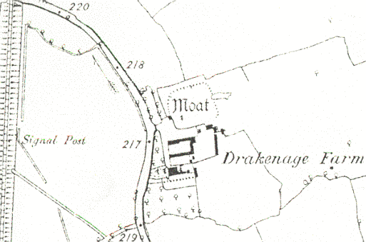
Moat at Drakenage Farm
The remains a moat, a wide ditch surrounding a building, which is Medieval in origin. It is visible as an earthwork and is situated at Drakenage Farm.
1 Waterfilled moat 80m E-W by 60m N-S with arms about 10m in width and a causewayed entrance midway along the S arm.
2 The remains of a homestead moat. By 1967 the S arm has been obliterated by farming and there were no surface indications of a building on the island. By 1976 ploughing had caused greater damage and only the outer scarp of the N, W and E sides remained. The moat originally measured 70m E-W and 60m N-W. A waterfilled pond outside the W arm measured 50 by 13m with remains of stone revetting along the E side, and is probably a Medieval fishpond.
3 Plan included on OS card.
4 Moat is of low amplitude and is dry, but still clearly traceable.
5 Designated a Scheduled Ancient Monument (1995).
- For the sources of these notes, see the
- Timetrail record
- produced by the Historic Environment Record.


Comments
Add a comment about this page