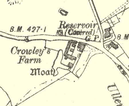
Moat at Crowley's Farm
Description of this historic site
The site of Medieval moat, a wide ditch usually surrounding a building. There is some documentary evidence for its existence, but only traces of earthworks survive. It is situated 250m northwest of the school at Ullenhall.
Can you help?
Notes about this historic site
1 W and SW arms of a moat just SW of Crowley’s Farm.
2 ‘Crowleys’ stands in a moated site.
3 The moat has been completely filled in.
4 Little remains except shallow traces of the W arm. It is not known when the E and N arms were filled in.
5 The field which surrounds the farm is called `Moat Ground’.
6 MSRG Index Card.
- For the sources of these notes, see the
- Timetrail record
- produced by the Historic Environment Record.


Comments
Add a comment about this page