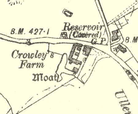
Moat at Botley Hill Farm, Ullenhall.
A moat, a wide ditch usually surrounding a building. It is still visible as earthwork, although it has now been mostly filled in. Its date is not known. It is situated 300m northeast of Blunt's Green, Ullenhall.
1 E of Botley Hill House are considerable remains of a rectangular moat with water.
2 1967: The moat is dry and has been much reduced. 1976: The best preserved part is the N part of the W arm where 26m of its original 40m length survives as a steep-sided dry ditch 10m wide and 3m deep. Fragments of the adjoining N and S arms survive in a mutilated form, but elsewhere the course of the moat could not be traced. Nevertheless the remains are sufficiently clear to identify it as a homestead moat. The original source of water supply could not be traced.
3 Little remains except the W side, which is largely overgrown and wet. The farmer is gradually filling this side in. Nothing remains of the N, S or E arms, apart from a low bank on the S side.
- For the sources of these notes, see the
- Timetrail record
- produced by the Historic Environment Record.


Comments
Add a comment about this page