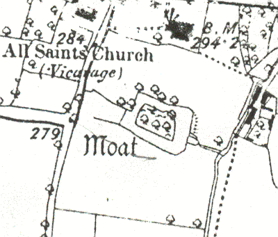
Moat 100m S of Church
The site of a moat, a wide ditch usually surrounding a building. It dated to the Medieval period, and is marked on the Ordnance Survey map of 1906. The moat is no longer visible as an earthwork. It was situated 100m south of All Saints Church, Stretton on Dunsmore.
1 Moat marked.
2 An ornamental/landscaped moat in a neglected condition. The causeway is of 19th century brickwork and the whole would appear to be of that date.
3 The site has now been built on and largely obliterated, although the stream which once must have supplied the moat is still there. The present house has a large (formalised) pond in its garden, probably the E side of the former moat.
4 The moat was filled in after the war with rubble from the Coventry blitz.
5 Moated sites survey.
- For the sources of these notes, see the
- Timetrail record
- produced by the Historic Environment Record.


Comments
Add a comment about this page