Cherington Medieval Settlement
Description of this historic site
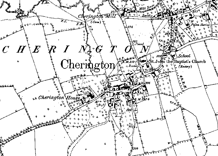
Probable extent of Medieval settlement in Cherington as indicated on the Ordnance Survey map of 1886.
Can you help?
Notes about this historic site
1 The likely extent of the Medieval settlement based on the first edition 6 ” map,57 NW 1884.
2 Cherington is not listed in the Domesday survey.
3 The 1886 map shows quite dense settlement. There is no clear boundary hedge, but it is suggested by footpaths on the northern side. The church [WA2349] and Cherington Mill [1891] both date from the medieval period. The parish has not been covered by ridge and furrow plotting. The map shows orchard/garden fields surrounding the village.
- For the sources of these notes, see the
- Timetrail record
- produced by the Historic Environment Record.


Comments
Add a comment about this page