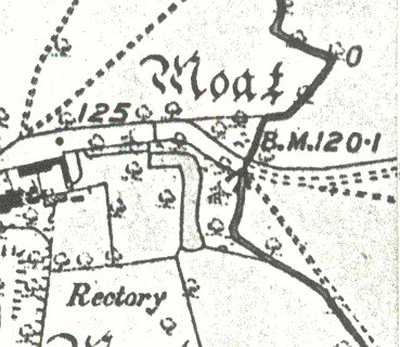
Braggington Moat
Description of this historic site
The site of Braggington Moat, a wide ditch usually surrounding a building. The moat is of Medieval date. It is visible as an earthwork and is situated at Braggington.
Can you help?
Notes about this historic site
1 A homestead moat.
2 Three sides of a presumably once square moat. It is waterfilled and in places appears to be stone-lined. The SE side was presumably obliterated by the construction of a farm building.
3 The moat is 10-15m wide, is wet and has a stone-lined revetment in places. Part of the SE side is shown on the 1926 OS map and has presumably been filled in since.
- For the sources of these notes, see the
- Timetrail record
- produced by the Historic Environment Record.


Comments
Add a comment about this page