Oldberrow Court Moat
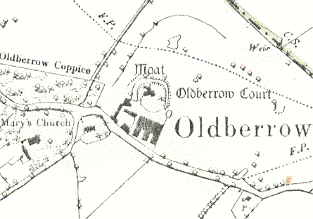
Oldberrow Court Moat, a moat being a wide ditch usually surrounding a building. It dates to the Medieval period, and is still visible as an earthwork. It is situated 100m northeast of St Mary's Church, Oldberrow.
1 A 16th century and later house is surrounded by a rectangular moat; the N and W arms of which still contain water.
2 The moat is overgrown and partly rubbish filled.
4 The situation of this site in close proximity to the church may imply an origin in a manorial context, but Oldberrow does not seem to have been an established manor at Domesday. Assessed at only 12 acres, the estate appears mainly to have consisted of woodland. The moat is approximately circular in shape, measuring 70 by 70m, the dimensions of the internal platform are approximately 49 by 49m. The S side has been destroyed by the construction of modern farm buildings, but the moat is clearly visible on the other 3 sides. It is now dry, but was still partly water-filled until recent times.
5 MSRG Card.
- For the sources of these notes, see the
- Timetrail record
- produced by the Historic Environment Record.


Comments
Add a comment about this page