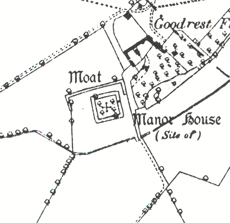
Goodrest Lodge Moat
Goodrest Lodge double moat, a wide ditch that surrounded a Manor House, of Medieval date. There is documentary evidence for its existence, and it remains visible as an earthwork. It is situated 450m north west of Nine Acre Plantation, Leek Wootton.
1 An enclosure about 33m square, surrounded by a well-defined moat. Outside this is another moat which is not so clearly defined. The entrance is by a well-built, double-arched stone bridge on the E side, 9.1m from the NE corner.
2 An old bridge over the moat was removed and doubtless rebuilt in 1441.
3 Scheduled as Warwickshire Monument 158.
6 The moat appears on several estate maps and is often called ‘The White Moat’. Water probably reached the moat from a lake (PRN 2259).
8 Three maps show the manor house. A map of 1682 shows a complete moat, while maps of 1750 and 1788 show the moat as incomplete, presumbably because the W side had dried up. In 1979 the new owners decided to clear the moat. A survey was conducted. The main moat platform is almost square and 32m by 32m. The ditch is irregular on its outer edge and revetted on the inner face with stonework. The ditch averages 10m wide and 3.5m deep. Access to the platform is by a stone bridge with two four-centred arches. The outer moat is less substantial, being on average 9m wide and 1m deep and is fed by the Cuttle Brook. Two ponds exist between the inner and outer moat (PRN 5284).
10 Rescheduled as SAM 21581.
- For the sources of these notes, see the
- Timetrail record
- produced by the Historic Environment Record.


Comments
Add a comment about this page