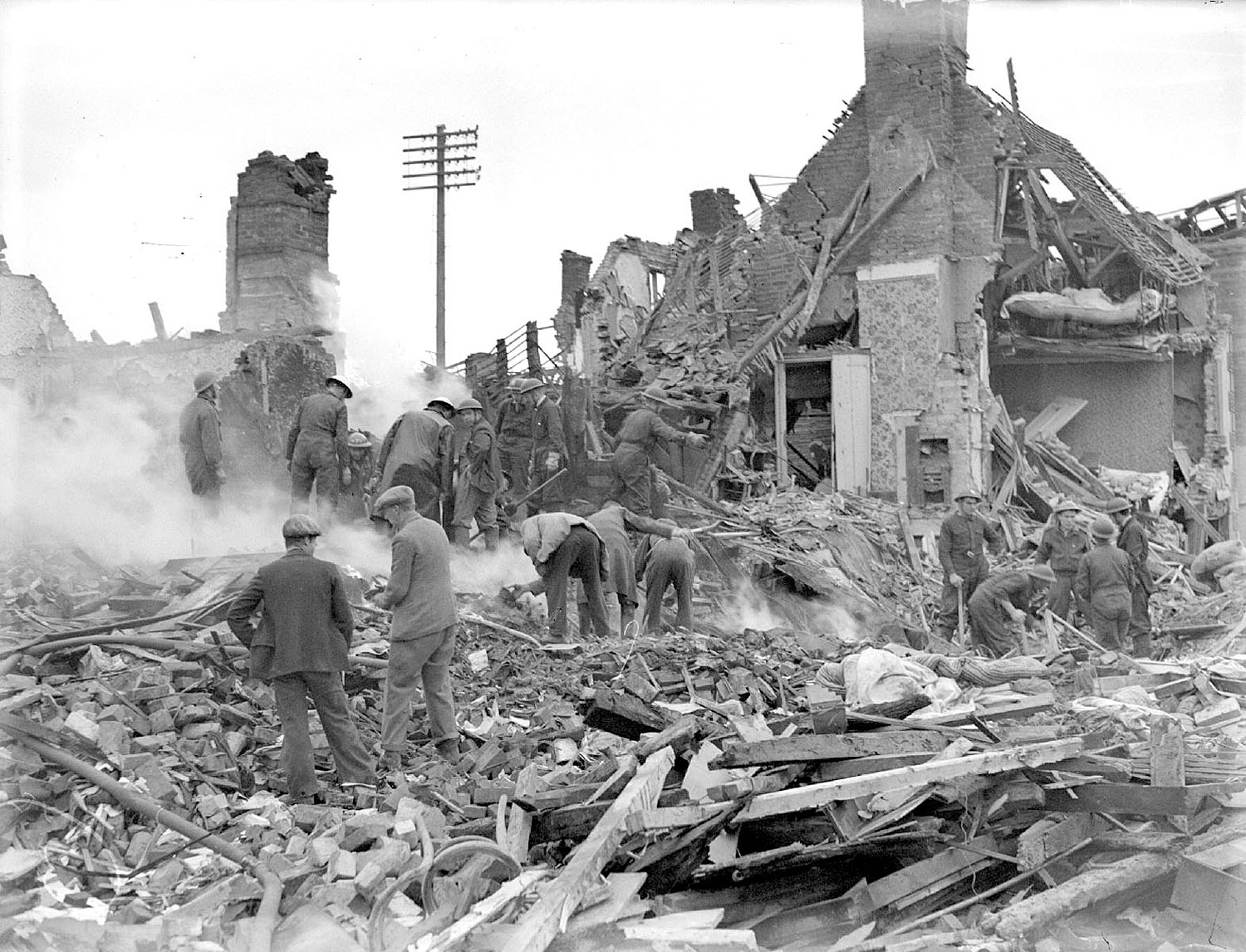
Kenilworth. Bomb damage in Warwick Road Workers sifting through bomb damage in Warwick Road, Kenilworth. 1940s IMAGE LOCATION: (Warwickshire County Record Office) Reference: PH(N), 600/279/9, img: 9376 This image is subject to copyright restrictions. Please see our copyright statement for further details. Map marker in the right place? If not, please correct the map. Locations Kenilworth (513) Subjects Air-Raids and Bomb Damage (31) Date 1940-1949 Comments Reply This is not Warwick Road, it is Abbey End, to the left, and The Square. The photograph is taken the morning the bomb fell, 21st November 1940 By Robin D Leach (04/05/2019) Add a comment about this page Your email address will not be published. Required fields are marked *Your comment:Name * Email * Website Save my name, email, and website in this browser for the next time I comment. I consent to my name and e-mail address being stored along with this comment, and to the website editors communicating with me by e-mail about the comment if necessary. My name may be published alongside the comment on the website, but my e-mail address will not be published. My information will not be shared with any third party (see our Privacy Statement - opens in a new window). * Δ Share this FacebookPinterestTwitterLinkedin
Comments
This is not Warwick Road, it is Abbey End, to the left, and The Square. The photograph is taken the morning the bomb fell, 21st November 1940
Add a comment about this page