


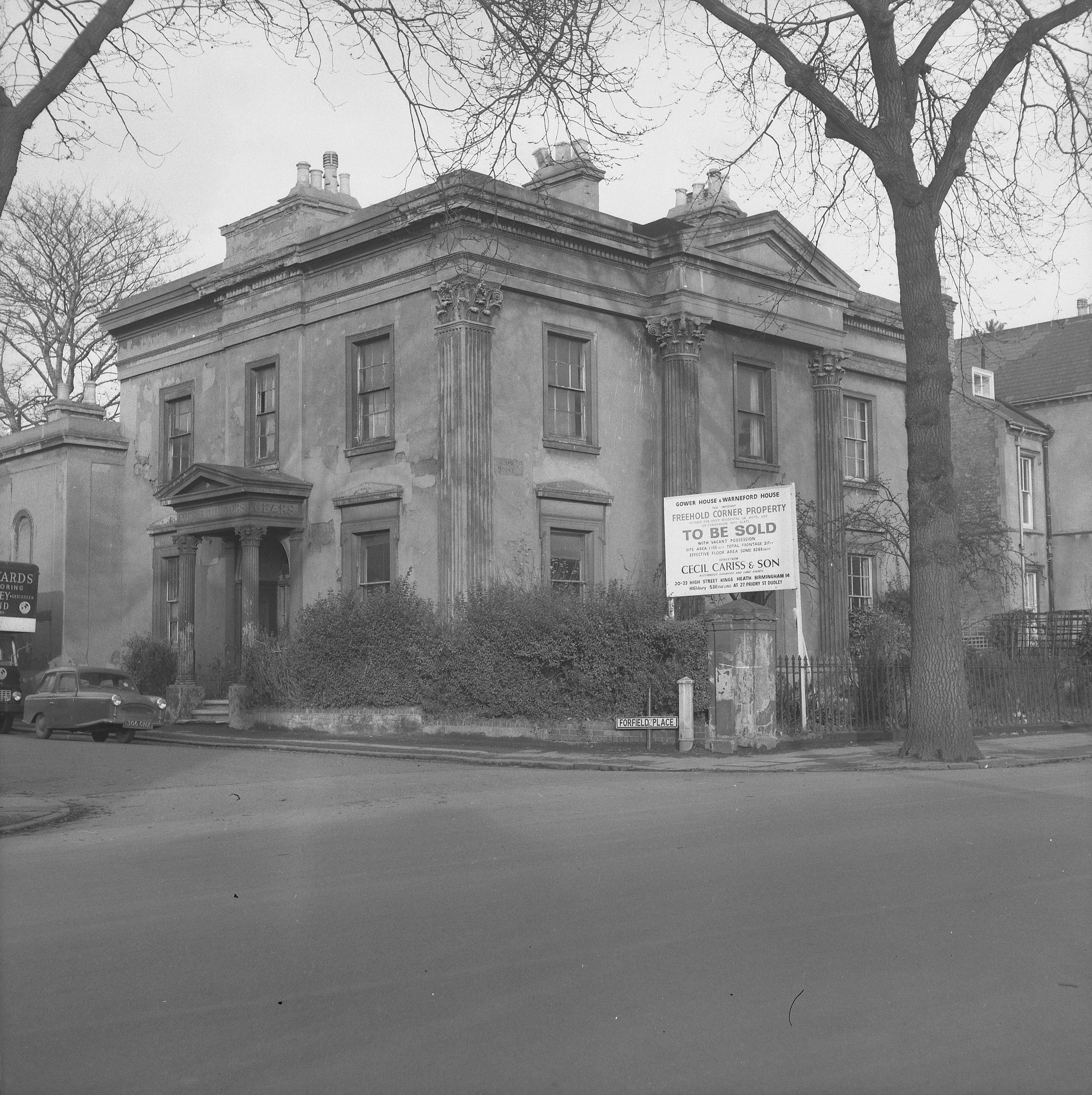
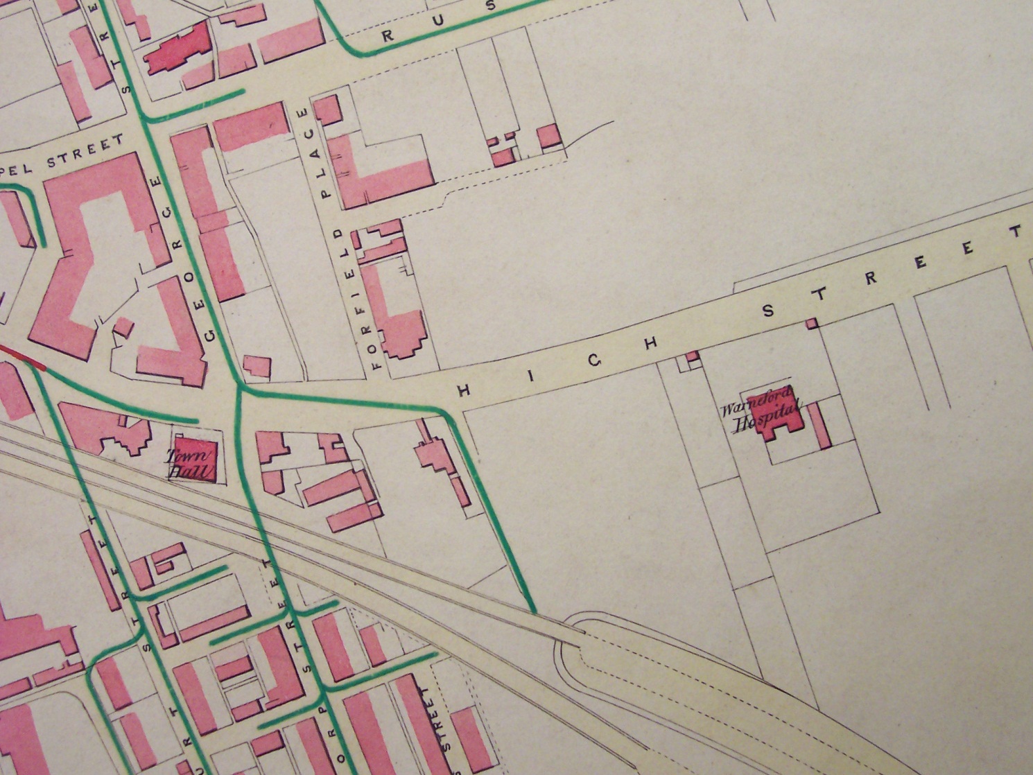
Gower House and Warneford House were two separate residences that made up a large regency style property which, at the time of its demolition, stood on the corner of Forfield Place and Radford Road, Royal Leamington Spa.
I say at the time of its demolition, because before 1890 the boundary between High Street and Radford Road seems to differ, depending on which map you look at! So part of the property is sometimes given as being in High Street, sometimes in Radford Road, and on the 1881 census it is recorded as being in High Street-Radford Road.
Introduction of postcodes
Before 1890, even in large towns and cities, many properties did not have numbers and even if they did the numbering could be rather haphazard. So in 1890 the Post Office undertook a nationwide project to give all properties an official postal address and to renumber said properties so that they, where possible, conformed to the standard still used today. i.e. even numbers on one side of the street and odd numbers on the other.
At this time the boundary between High Street and Radford Road was set at their junction with Althorpe Street and George Street, with part of the property being given the address 13 Forfield Place, and the other part was labelled 11 Radford Road.
Using maps to date the property
I have found three maps that help tie down when the property was built. The first dates from 18181 and shows no buildings on the north side of High Street beyond what is now Packington Place. Inspection of the map also shows that George Street and Forfield Place etc. have yet to be built. The second is a map of 18342, this does show building further along High Street/Radford Road, including Forfield Place, as yet unnamed. The site of the property however, is part of an area marked for ‘intended building’. The third is a map of 18413, it is dated for September of that year and does show the property.
The above suggests that the property was built between 1834 and 1841. To try and narrow things down further I looked at the Parish Rate Books from 1840 back4. These show no record of the property before 1835, which seems to confirm that it was built sometime during 1834.
During its life the building had many roles. It served as a lodging house, a private hospital/nursing home, and a motor cycle engineers as well as a private residence.
Falling into disrepair
Unfortunately, it suffered the fate of many of Leamington’s once fine buildings. After the Second World War it slowly fell in to disrepair until it was sold by its elderly owner; it was then demolished and a block of modern flats built on the site. This was in 1968, and if it had lasted into the 1980s it might have survived to be converted. But in the 1960s even the fact that it was listed could not save it.
References (all Warwickshire County Record Office)
1 CR351/1082
2 CR580/Box 64
3 CR351/1084
4 DR 514/92-95


Comments
Forfield were motorcycles produced circa 1920 by H. J. Stretton-Ward of 11 and 13 Forfield Place, Leamington Spa.
The firm was small and had previously been involved with Triumph and Premier Cycle Co. Stretton Ward held several motorcycle agencies and manufactured the Forfield at his offices and works of the same name. As the machines would have been very basic and sales low, he soon found it more convenient to sell the products of others instead.
H J Stretton Ward was also a renowned photographer of railways. Miss Pinder also lived there and she dealt in books on transport subjects mainly railway connected
Very interesting article Richard, well researched and well illustrated. I must have walked past this imposing house scores of times as a school boy but have no recollection whatever of its being there. Rather sad to think that such an impressive building was swept away in the 1960’s frenzy of demolition but good that local historians can still conjure them up for us fifty years on.
Thanks Alan for your kind comments. Much the same as you, living in Camberwell Terrace until I was eight, I must have walked past this house hundreds of times and had forgotten all about it until I came across the photos.
I’m sure you’ll both be pleased to know that Richard has gone into a quite remarkable level of detail about the house. There’ll be more articles published on the site in the coming weeks about the house and its residents.
Mr and Mrs Stretton-Ward were my uncle and aunt and from childhood my mother, sister and I stayed with them at Gower House a number of times. Although they appeared to be separate houses, they were actually joined by a funny little passage on the ground floor and they shared the garden area at the back. Gower House was never, to the best of my knowledge, used for the motor cycle business, which was carried out from the building on the opposite corner of Forfield Place and Radford Road. Miss Pinder was my uncle’s secretary and lived in another part of Leamington Spa. I remember going to have tea with her, but sadly can’t remember where her house was.
Add a comment about this page